News
2011-10-15
Initial mapping
Early in the project, (September 1, 2011), it was decided to travel the 130 km line shortlisted in the project before autumn.
The total area of selected sections represent nearly 620 hectares, when they have been fully secured to 50 m wide. But at the time of mapping, 517 ha (83%) were non-forested.
Indeed, over recent years, the Company Elia, had a policy of expanding security corridors *. This work is not yet completed and, to coordinate our actions, we deal with the technical services of the Company to define areas where felling will be take place soon.
* The Belgian electric power transmission network, entirely managed by the company Elia, is a key link between France, the largest electricity exporter in Europe, and Northern European markets. The Company Elia must ensure a flawless electricity supply. Therefore substantial efforts are made by the operator to reduce the risk of falling trees on the facilities.
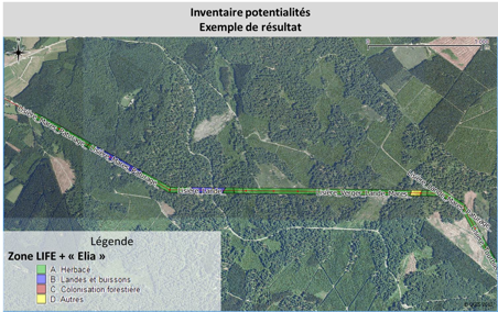
These 517 hectares have been characterized by the following criteria : description of the security state of the line, types of habitats, 'LIFE' restoration actions that can potentially be implemented (edges, ponds, grazing moor ...).
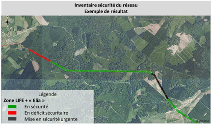
A first step resulted in an inventory of the safe condition of power lines. This dataset is imported on computer in a Geographic Information System to the level of each staff (space between two towers) and characterizes the situation of power lines whether the security is absolutely safe, secure or deficient, for which a formal securisation is urgent (see box below).
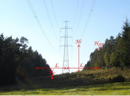
During this inventory, to enable us to confront our opinion with the operator Elia, six types of data were recorded for each area (Fig. 1):
-
Corridor width to L (m)
-
Height of the line at the lowest point to H (m)
-
Height of the vegetation in the line Hv (m)
-
Stand height Hppt neighbor (m)
-
Stand type neighbor
-
Corridor widths sufficient?
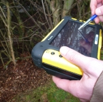
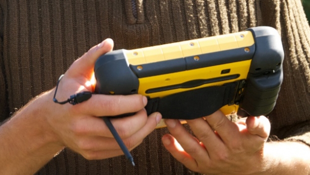
In the second mapping campaign, the 130 km of lines were covered on foot by field teams, equipped with GPS on which standard forms were filled in. Three aims have been fulfilled :
-
Define the type of environment present in the overhead lines in terms of structure of the site (slope and inclination of the corridor) and in terms of habitats among the 19 types most commonly encountered;
-
Then, depending on field characteristics, every actions potentially achievable were listed for each homogeneous zones. This will allow us to have an overview of the actions that can be performed. Subsequently, based on these data, we will consult the technical services successively Elia, forest managers (DNF) and the owners for, by elimination, set up the most appropriate actions or combination of actions.
-
Finally, to illustrate our inventories, front and rear photographs were taken for each inter-tower staff. These photos were geo-localized and will be available on the website.